Urban areas are facing enormous challenges: escalating population and energy consumption, connected and automated transport, information system development to meet resident and governance needs. Digital twins at the urban scale are transforming how cities are planned, built, and managed to better deliver services to citizens. Digital twins generally include static point-in-time models of the physical objects, as well as, dynamic models that update predictions in near real time using ubiquitous sensor feeds. Building on previous smart city developments, Urban Digital Twins - using the fundamental framework of space and time - will become the tools and methods for high density human settlements to be more livable, inclusive, safe, resilient and sustainable.
The Location Powers: Urban Digital Twins summit will convene experts on urban geography, planning and governance; supported by civil engineering and BIM for design, model and operation of physical infrastructure; along with data science, machine learning, cloud computing, edge computing for information infrastructure. Cities ranging in size and economic prosperity are to be considered leading to recommendations supportive of urban development goals, e.g., UN SDG. Success requires collaboration of multiple tiers of government, the private sector, public utilities, building owners, community groups, etc. Several levels of scale in space and time will be considered, from city dashboards for real time situational awareness (e.g., transportation) to scientific datasets and analysis (e.g., public health), on the scale of long term urban sustainability.
The Location Powers series brings together industry, research and government experts from across the globe into an interactive discussion that assesses the current situation and produces recommendations for future technology innovations and standards development. The summit will build on themes from previous Location Powers: Big Data, Data Science, Smart Cities, etc. The Location Powers summits drive technology innovation conducted by members of the Open Geospatial Consortium (OGC).
#LP_UDT
Sessions 1: Opening Keynotes and Digital Twin visions
Sessions 2: Tech depth and applications
Sessions 3: Recommendations, Actions, and workshop summary
Each session will be convened twice, once in western timezones and once in Eastern timezones. The themes of the two will be the same but the content will differ. Provision to connect the sessions will be undertaken.
| West: Europe, UK, US workday 1500 to 1800 UTC |
|---|
Session 1W -
Tuesday
|
Session 2W -
Wednesday
|
Session 3W -
Thursday
|
| East: Australia, Japan, Singapore workday 0200 to 0500 UTC |
|---|
Session 1E -
Wednesday
|
Session 2E -
Thursday
|
Session 3E -
Friday
|
| Session 1W - January 12th, 1500 - 1800 UTC [Summary Agenda] |
Summit Welcome
|
Session 1W Opening:
|
| Session 1E - January 13th, 0200 - 0500 UTC [Summary Agenda] |
Summit Welcome
|
Session 1E Opening:
|
| Session 2W - January 13th, 1500 - 1800 UTC [Summary Agenda] |
Session 2W Opening:
|
| Session 2E - January 14th, 0200 - 0500 UTC [Summary Agenda] |
Session 2E Opening:
|
| Session 3W - January 14h, 1500 - 1800 UTC [Summary Agenda] |
Session 3W Opening:
Summit Closing: George Percivall, OGC CTO |
| Session 3E - January 15th, 0200 - 0500 UTC [Summary Agenda] |
Session 3E Opening:
Summit Closing: George Percivall, OGC CTO |

New York City Council Member

Councillor of Office for Promotion of Regional Revitalization
Head of the National Digital Twin Programme at the Centre for Digital Built Britain
Esri, Group Product Manager, Geoenabled Systems
Director and Secretary, BuildingSMART Australasia

IT and Innovation Director, Aguas do Porto
Senior Director | Digital Cities, Bentley
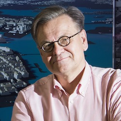
HELSINKI 3D+ / Project Manager / Architect / M.Sc (Civ.Eng)

Commons Lead, National Digital Twin Programme, Centre for Digital Built Britain

Director Sales & Marketing, Virtual City Systems

Canada Excellence Research Chair (CERC) for Next Generation Cities at Concordia University Montréal
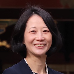
Asia Air Survey Co.,Ltd.

Strategic Lead, Digital Twin, Victoria State Government
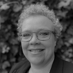
Adviseur & Programmaleider T3D (registratie) en Rotterdam 3D

National 3D Sales Manager, Aerometrex

Senior Manager, Panasonic Corporation Life Solutions Company
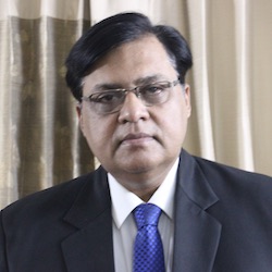
Deputy Director General, NIC
System Integration Consultant, Trimble

Urban Structure Visualization Promotion Organization (USVPO)

Vice President, Reality + Spatial Modeling, Digital Cities

Director, GeoSpatial and Data & Chief Data Officer, Singapore Land Authority

Professor, Hochschule für Technik Stuttgart

Senior Program Manager at Microsoft, Azure IoT - Smart Cities, Microsoft

CEO and Co-Founder of PEOPLE AND TECHNOLOGY
DAFNI Project Lead, STFC

Senior Vice President, Digital Cities, Bentley Systems

President, NYC Geospatial Information Systems and Mapping Organization (NYC GISMO)

Professor of Urban Informatics & Director of Citizen Science at the Center for Urban Science & Progress and the Department of Civil and Urban Engineering at New York University

Chief Geospatial Scientist
Ordnance Survey

Open Platform Product Manager
Esri

Committee member on interoperability of super city and smart city, Cabinet
Office of Japan
Chair of committee on interoperability, Urban Structure Visualization Promotion Organization -
USVPR
CTO, Chief Engineer
OGC

Head of Geospatial Research, Innovation and Development (GRID) lab,
School of Built Environment, UNSW Sydney Australia,
President ISPRS Commission IV 'Spatial Information Science'

Senior Manager, Geospatial and Data Division, Singapore Land Authority

Senior Solutions Manager, Public Sector Americas Sales, HERE Technologies

Director Innovation Programs | Open Geospatial Consortium (OGC)

Professor & Director at Australian Urban Research Infrastructure Network
CEO, Strategic Commercialisation Australia
Meeting Location: